|
|
|
|
|
|
 |
 |
 |
|
|
|
|
Your Price: $ 65.00
Item Number: car130
|
|
|
|
|
|
| | We also accept Checks and Money Orders. |
|
|
|
|
|
 |
|
 |
|
|
|
|
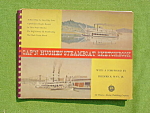
Early Pair of Ohio River Navigation Chart Books. One is from the Pittsburgh District covering Pittsburgh, Pa. to Powhatan Point, Ohio and the other is the Huntington District covering Powhatan Point, Ohio to Aberdeen, Ohio. Maps are from the U.S. Army Corps of Engineers. Map Books are from the 1940's to 50's era. Various Maps featured along the River of nearby cities/towns. One has about 60 charts and the other 23. Books measure 14 1/2 x 9". Some wear the covers but pages within are fine. Great to add to any Map or Boat Navigation collection. Buyer to pay shipping. |
|
You might also like:
|
|
|


